Friday, 2 February 2018

Adventure Touring in North Thailand - Phayao to Golden Triangle

Since day 3 was an extremely long one, we were pretty glad to have made it to the lakeside town of Phayao comfortably. Of course, that meant a visit to the Phayao Lake would take place next morning.  
View of the Phayao Lake
Phayao is a small town with only 20,000 inhabitants and a very relaxed atmosphere. The main attraction here is the Kwan Phayao, one of Thailand’s biggest lakes! Fun fact- it is an artificial lake. The lakeside promenade is home to countless guesthouses, restaurants and bars which meant our evening was sorted!!
I’ve got to admit that after the second day, luck was on our side as far as weather was concerned. The rain had disappeared, albeit temporarily and that meant it was a great time to embark on the second loop of our ride- the Golden Triangle, which had already begun when we bypassed Chiang Mai on the way to Phayao the previous day.
Entering the province of Chiang Rai
Golden Triangle, the point where three country borders converge, is another classic motorcycling loop in north Thailand that takes you all the way north in the Chiang Rai province to the border area with Burma and Laos.
Mandatory picture!
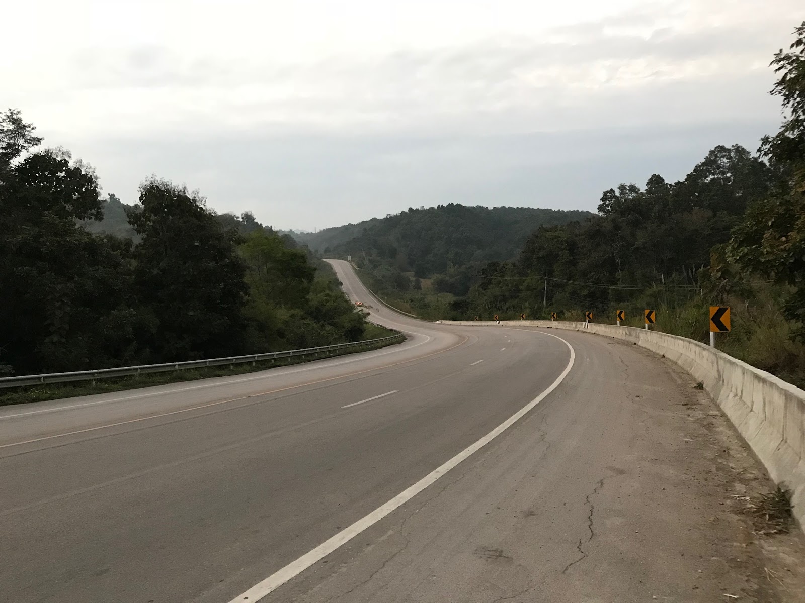
Our ride today, an extremely relaxed 160 odd km, was predominantly going to be on Route 1 (also known as Route 1208), the super highway that connects Bangkok with the northernmost parts of Thailand. As the name suggests, this highway is just droolworthy. With about 2 hours of ride time to our final destination, we decided to take it easy and left Phayao at 11 am!
My ride for the day- the Yamaha FJ09
The first scheduled halt for the day was at one of the top 10 wondrous temples of the world- The Wat Rong Khun or White Temple as it is popularly known, 65 km from Phayao. With its extravagant and unique architecture, the temple reflects visions of heaven, hell and nirvana (that’s just some trivia I had read :P)
Majestic!

Gorgeous, isn't it?
Wat Rong Khun is a true masterpiece and very unique- the temple differs from all other, colorful Thai temples, because it is completely white. The temple’s walls are covered with a special plaster mixed with tiny particles of glass that create a beautiful glittering effect. Moreover, it turned out to be one of those really bright sunny days, which meant we could get some really kickass snaps of the white temple!
Another cool thing that we saw here was a tree decorated with the heads of well-known comic characters. Something like this -
                                 
                                          
After spending about an hour here, we left for our final destination- the Golden Triangle via Chiang Saen, a busy trade centre in the Golden Triangle region. About seven kilometres after Chiang Saen you reach the renowned Golden Triangle. Indeed a super-relaxed ride!
Thailand

Our hotel room was overlooking Myanmar and Laos by the mighty Mekong river. Basically, we were staying in one country and were able to see the other two through our balcony! 
The Mekong River separates the three countries that form the Golden triangle. Fun fact- This is the world’s 12th longest river and the 3rd longest in Asia with an estimated length of 4,350 kilometers. Mekong originates from the Tibetan Plateau and runs through China’s Yunnan province, Myanmar, Laos, Thailand, Cambodia and Vietnam before finally meeting the South China sea.  
If you see this statue, you have arrived at the Golden Triangle!


Without wasting any time, we decided to go and check out the famed Donsao Island- the Laos island at the Golden Triangle which is a free-zone meaning no visa is necessary to enter this territory. A speedboat ride (one of the highlights of the place) at the confluence of the Mekong and Ruak rivers brings you to this island. 
Again, a mandatory picture!
Enroute Laos in a speedboat

Laos looked beautiful!
In the distance you also get a good glimpse of the rumored to be shut, Myanmar casino which was built to cater to Chinese gamblers. 
Must be a crazy casino! (Burma)
The Golden Triangle was once a dangerous land of opium, drug lords and rebel militia but today is known for some of finest Thai roads. The road network built during the region’s dark past now serves as a paradise for motorcyclists across the world.
If you want to pamper yourself or your loved ones by exceeding all your limits, you can stay at supposedly the world’s best resort, Anantara Golden Triangle, complete with baby elephants that roam around freely inside! (it would cost you only 75000 THB per night!!! :P)
I wish someone sponsored a night's stay here for me!! :(
Stay tuned as we learn more about the dark past of this region and make our way to the northernmost point of Thailand!
Riding Distances:-
1) Phayao- White Temple – 80 km
2) White Temple – Golden Triangle – 85 km

Tuesday, 30 January 2018

Adventure Touring in North Thailand - Mae Hong Son to Phayao

After rain in patches played spoilsport on the second day of our ride, we decided to make the most of the incredible weather instead of heading towards our originally intended destination, Mae Sariang. Even though that meant catching up an additional 160 km on the next day to put ourselves back on track with our original itinerary, we were absolutely okay with it. Taking unwanted risks by riding in such weather, that too in the dark, made no sense. 

Our decision indeed turned to be a blessing in disguise, courtesy an amazing villa resort that we discovered on the outskirts of Mae Hong Son town to spend the night. You can check out more details and pictures of Ban Phumon Talang Resort here

Post-dinner, while chalking out the ride plan for day 3, we contemplated if it was worth riding 160 km all the way to Mae Sariang and then crawl back towards Doi Inthanon, the highest point in Thailand or take a detour from Route 108, 85 km after Mae Hong Son at Khun Yuam & continue inwards on Route 1263. Continuing for an additional 75 km on Route 108 that consisted of mostly straight roads with very few curves seemed uninteresting! Of course, our motorycles demanded adventure and we had to give them that!! ;-) It was finalized then-  we would make our way to the highest point in Thailand via the more picturesque Route 1263.

Route 108 enroute Khun Yuam

Despite the altered plan, we were still staring at the longest ride day of our trip with the intended final destination, Phayao, a solid 550 km away. Add to that the bad weather. It was without doubt going to be extremely challenging. Starting early seemed to be the most practical option so we could make the most of daylight. Weather forecasts showed heavy rains post 10 am so we decided to exit Mae Hong Son by 8:30 am praying that the rain Gods would be by our side!

Route 108 enroute Khun Yuam

There was a slight drizzle while we left Mae Hong Son, but not so much so as to put us in a state of bother. The first major town enroute was Khun Yuam, 85 km south of Mae Hong Son, from where we exited Route 108 and got onto Route 1263, exactly as discussed the previous night.
Thats where we exited Route 108 and got on to Route 1263

Thats how coffee is served in small towns here

With some rough pothole-filled stretches, it was tough. But still way better than the road conditions back here at home! Mae Chaem is the last town before the long climb to the summit of Doi Inthanon. But we were very happy and satisfied because the weather had been on our side right from morning. You can find more information about the activities you can indulge yourself in Mae Chaem here.

Enroute Mae Chaem

Enroute Mae Chaem

Here is where the steep climb begins

It was the perfect spot to refuel ourselves and the bike for the long long ride still ahead of us. After  Mae Chaem begins the steep ride up to the Doi Inthanon summit. The smooth curves and extremely pleasant weather make for a fantastic ride. Initially the curves are wide but as you climb further, the road becomes extremely narrow and stays so for the next 8-10 km. With vehicles moving in both directions, you've got to be very cautious. A very steep route carves its way through a swathe of cool forest and if the weather is clear at the summit you’ll be in for a magnificent spectacle. Most often, the place is extremely cloudy but it is worth the risk even if don’t get the view of the valley from the top. Atleast that is what we had heard! 

Also known as "The Roof of Thailand", Doi Inthanon National Park covers an area of 482 km² in Chiang Mai province in the north of Thailand. The national park is part of the Himalayan mountain range (Surprised? Yes? These are considered the foothills of the Himalayas that stretches from Nepal, Bhutan, Burma all the way up to northern Thailand) whose elevation ranges between 800 and 2565 meters with the highest peak at Doi Inthanon, the highest mountain in Thailand. Due to the high altitude (please don't compare this altitude with Ladakh or Spiti valley :P ), the park has high humidity and cold weather all year round. The average daily temperatures are normally around 8-12 °C, which means it is very, very pleasant throughout the year. 

The climb up to Doi Inthanon

Just before the top

Final climb to the top of Doi Inthanon


Mandatory picture

At the top of Doi Inthanon

Focus on the board, not anything else :P

Thai Royal office while getting down from Doi Inthanon

Mae Klang

  
It’s a simple ride back to Chiang Mai on the overwhelmingly uninteresting route 108, but that said, it does give you time to reflect on that amazing journey across north-west Thailand.

Straight road all the way to Tharnthong from Chiang Mai
With this, the Mae Hong Son loop was off the checklist! One loop done and it was time to embark on the second loop of our journey- in the north-east.  Our plan was to stop for the night at Phayao so we bypassed the city of Chiang Mai and decided to head towards our next destination- Tharnthong Lodges.

Be warned- Do not underestimate the place because of its name. Even if just want to have tea here, it is well worth your time for the astounding natural beauty it offers. Tharnthong Lodges is located 45 kilometres east of the city of Chiangmai and over 700 metres (2,300 feet) above sea-level. Its pristine location in the middle of a long valley in a headwater catchment of verdant rain-forest will leave you spellbound. In this beautiful setting, a rocky-filled running stream feeds the highland plantation and provides water for the peaceful and quiet villages downstream. 

Entrance of Tharnthong

Entrance of Tharnthong

Inside Tharnthong


Inside Tharnthong


The restaurant at Tharnthong

Inside Tharnthong
  
Here is where a real sense of relaxation can be found to soothe both your body and soul. The spectacular scenery and mountainous location make it an ideal getaway for nature lovers without foregoing the comforts of their home. You can find more details about Tharnthong Lodges here

Well, it was almost 5 pm now with Phayao still about 140 km away. However, the grueling part of the ride was long over and with 125 km of the remaining ride on smooth straight highways, we were pretty much relaxed. The black clouds had disappeared after Doi Inthanon so weather was not a constraint now. Our next destination, Mae Khachan Hot Spring, was on the highway itself so all we needed was a 10 minute halt to refresh ourselves. 


This is what we got just on the opposite side of the road of the hot springs

Extremely hot hot springs
 

Located in the Chiang Rai province at Mae Chedi Mai of Wiang Pa Pao District, this hot spring is very popular among Thai People to stop on the way to Chiang Mai (if travelling in the opposite direction) or Chiang Rai (the direction we were headed). As a tourist, you will be approached by locals who try hard to sell you eggs which you can boil in the hot spring. 

The roads never seem to end!

Turning to enter the state of Phayao

Enroute Phayao
After we got back on our motorcycles, we hardly had about 30 minutes of daylight left, but as I mentioned absolutely stress-free because the ride all the way now was on a straight highway. It is here when you just want to take your hats off and admire the road discipline and sense of the Thai people. No honking, no high beams, giving way to motorcycles, no driving in the wrong lane and everything else that you wish for while riding in the dark, the folks do that for you, more so if you are on a motorcycle. An extremely relaxed ride even in pitch darkness meant we made it comfortably to our hotel in Phayao by 8 pm.

Finally relieved to enter Phayao

Wow! About 550 km in a single day with so many halts. What was truly unimaginable had now been completed. And without dropping a sweat! We decided to freshen up and relax at a riverside lounge. Since it was totally dark, we decided to come back again to see Phayao Lake in the morning to get a glimpse of the view it offered before making our way further northwest of Thailand! 

Phayao Lakeside
Stay tuned as we make our way further north in the Chiang Rai province to enter Laos and Myanmar in emphatic fashion! :P

Riding Distances:- 
1) Mae Hong Son – Khun Yuam  (80 km)
2) Khun Yuam – Doi Inthanon via Mae Chaem (155 km)
3) Doi Inthanon – Tharntong (150 km)
4) Tharntong – Mae Khachan Hot Springs (55 km)
5) Mae Khachan Hot Springs - Phayao (85 km)

Tuesday, 23 January 2018

Adventure Touring in North Thailand - Pai to Mae Hong Son

Day 1 of our ride from Chiang Mai to Pai had been spectacular, thanks to some impeccable roads and beautiful mountains, national parks and waterfalls. Most importantly, the discipline and road sense of locals and tourists alike made our ride extremely enjoyable and stress-free.

Even though completing the Mae Hong Son loop was definitely on our mind (well, that is what we were here for!), I had prepared the itinerary mindful of the fact that any and every place worth seeing enroute was not to be missed. Even though the main towns on the Mae Hong Son loop are Pai, Mae Hong Son and Mae Sariang, we felt it made no sense to just ride and munch miles for the sake of checking the loop off the list! If we were to cover everything enroute, it obviously meant too many detours. However, it did not really matter at all as long as we were all having fun.


This day was going to be long and exciting because of many exciting places that we were scheduled to ride to before we reached our final destination. We had anticipated a long day and hence left Pai at 8.30 am, with a stopover for breakfast at the small, charming town of Pang Mapha, also called Soppong, about 45 km from Pai. The road to Soppong is extremely windy and steep, but the smooth and sweeping curves make it a gorgeous ride. A massive mountain pass midway between Pai and Soppong provides a beautiful view of the mountains of Chiang Mai state.

At the high mountain pass between Pai and Soppong
View of the Mountains at a pass between Pai and Soppong

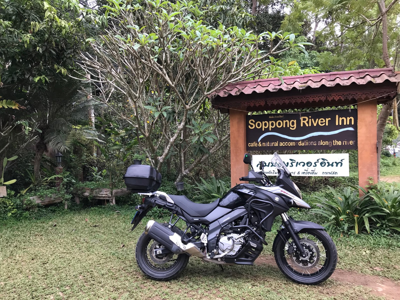
Having read a lot of positive reviews about Soppong River Inn, that was 100% going to be our breakfast halt. A beautiful riverside cafĂ© that stands tall on bamboo cantilevers, the flowing muddy river is a treat to hear and watch as your breakfast is getting ready!  


The main attraction at Soppong is the famous Tham Lod Cave, a massive cave that can be explored on a bamboo raft! A running stream with loads of fishes chasing you make it an adventurous ride to the farthest cave. For the locals here, tourists are their only source of livelihood. And rightly so, the government has made it mandatory to take along a guide, who knows each minute detail of the cave inside out. Though it took us almost a couple of hours to check out all the three sections within the cave, the visit was well worth it!


The entrance of Lod

Entering Lod Caves

You can see the bamboo rafts down there!


The majestic Lod Caves
After a lovely visit to Tham Lod caves is where the weather took an ugly turn. It started raining and we were caught totally off guard. We were totally unprepared for showers because January and February are considered dry months in this part of Thailand. Hence, we did not carry any rain gear along with our usual motorcycle kit. Nevertheless, we decided to keep moving towards our next destination, Ban Rak Thai, a good 90 km away, in the hope that it would eventually stop raining.

Rain rain go away! Enroute Ban Rak Thai in rains


Loads of caves and waterfalls enroute!
About 20 km before Mae Hong Son, a right turn at a fork will put you on the road to Mae Aw or Ban Rak Thai, a small Chinese outpost village at the Thai-Myanmar border. While chalking out the itinerary, I had read that the scenery along the route will feel reminiscent of medieval China with tea plantations on both sides surrounded by thick dark green forests. Well, the last 25 km were exactly like what I had read! 

Customary picture with the signboard

Clicking pictures at the Thai-side before crossing over into Myanmar!


Entering Shan State (Burma)

And we were inside Shan State or Myanmar or Burma or whatever you call it!
When you move further on, you will be enamored by the views the serene lake offers, realizing that your effort has been absolutely worth it. Get yourself a cup of Oolong Tea and some locally grown dry-fruits as you soak in the tranquility! 

Small border town of Ban Rak Thai


The beautiful lake at Ban Rak Thai
Well, the rain Gods had decided not to show any mercy on us or so it felt! Here we were at Ban Rak Thai, already drenched, when it started raining again! It was 4:30 pm when we started sipping our teas and with another 140 km to go till Mae Sariang, we decided to halt at Mae Hong Son, 35 km from Ban Rak Thai and continue the ride the next day! 

Welcome to Mae Hong Son province
This decision of ours turned out to be a blessing in disguise, because we managed to find our best accommodation in North Thailand- an exotic fully furnished villa with secure parking! In stark contrast to the nearby Chiang Mai and Pai, the houses and temples in the town center of Mae Hong Son have notable Shan-state style influence, obviously because of its proximity to the Burmese border. (By the way, the armed groups at the Ban Rak Thai border check post preferred to call themselves citizens of Shan State and not Myanmar!)

Regarded as the most mountainous province in Thailand and famous for its untouched beauty and rugged wilderness, Mae Hong Son is indeed spectacular! One of the many places where some introspection makes you contemplate how amazing your passion for travelling indeed is! Because these are the kind of places you would never have come to otherwise!

Riding Distances:-
1) Pai- Soppong: 45 km
2) Soppong – Lod Caves: 11 km
3) Lod Caves- Ban Rak Thai: 90 km
4) Ban Rak Thai – Ban Phumon Talang (Mae Hong Son): 50 km

Stay tuned as we visit Thailand's highest motorable road the next day!